Breckenridge, Tennessee Pass Map NATIONAL GEOGRAPHIC Trails Illustrated Colorado
-
- Englisch ausgewählt
Fr. 22.90
inkl. gesetzl. MwSt.,
-
Kostenlose Lieferung ab Fr. 30 Einkaufswert
Schweiz & Liechtenstein:
Versandkostenfrei ab Fr. 30.00
Versandkosten bis Fr. 30.00: Fr. 3.50Andere Lieferländer
Fr. 18.00 unabhängig vom Warenwert
Beschreibung
Produktdetails
Einband
Karte
Erscheinungsdatum
26.03.2019
Verlag
National geographicMaße (L/B/H)
19.1/10.6/0.7 cm
Gewicht
70 g
Auflage
2019th edition
Sprache
Englisch
ISBN
978-1-56695-322-1
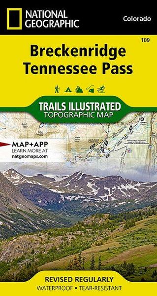
Coverage includes the Pike, San Isabel and Arapaho national forests, Alma State Wildlife Area and the cities of Leadville, Como, Breckenridge, Climax and Alma. Also included are the Blue River, Turquoise and Robinson lakes, and Montgomery Reservoir. 14ers: Mt. Lincoln, Bross, Democrat, Cameron and Quandary peaks. Boreas, Mosquito, Hoosier, French, Georgia, Freemont and Searle passes. Ski areas: Breckenridge, Copper Mountain and Fairplay cross-country. 10th Mountain Huts: Jackal Hut, Vance's Cabin, Janet's Cabin, Fowler Hilliard Hut and Francie's Hut. Portions of the Continental Divide Trail and Colorado Trail are included on this map. Includes UTM grids for use with your GPS unit.
Kundinnen und Kunden meinen
Verfassen Sie die erste Bewertung zu diesem Artikel
Helfen Sie anderen Kund*innen durch Ihre Meinung