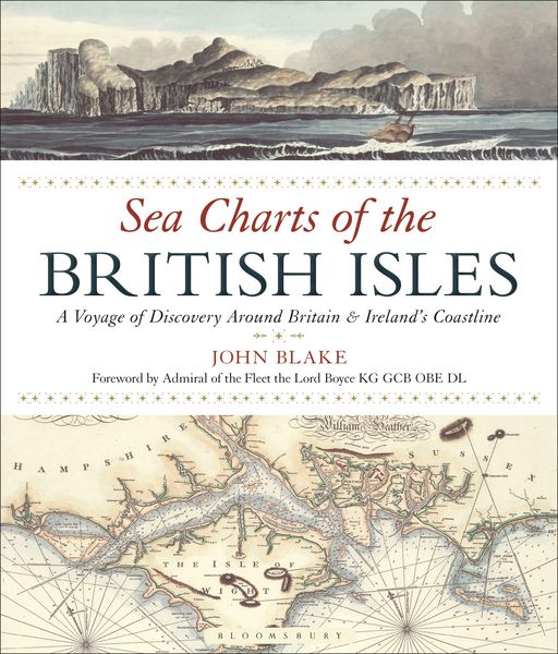
Blake, J: Sea Charts of the British Isles A Voyage of Discovery Around Britain & Ireland's Coastline
-
- Hardcover
- Taschenbuch ausgewählt
-
Sprache:Englisch
-
Verlag:Adlard Coles
Fr. 37.90
inkl. gesetzl. MwSt.,
Beschreibung
Produktdetails
Einband
Taschenbuch
Erscheinungsdatum
15.12.2016
Abbildungen
More than 110 full-colour maps and illustrations
Verlag
Adlard ColesSeitenzahl
128
Maße (L/B/H)
27.8/23.9/1.2 cm
Gewicht
744 g
Sprache
Englisch
ISBN
978-1-4729-4490-0
Travelling along the British coastline, Sea Charts of the British Isles showcases a beautiful collection of charts containing a wealth of information about Britain's maritime history and the story of charting and surveying itself. The great names in British chart-making are all included, such as Captain Greenvile Collins, Professor Murdoch Mackenzie and his nephew of the same name, Graeme Spence and William Bligh who between them created the first structured attempts to survey and chart particular areas of the coast of mainland Britain as well as the more remote islands.
Examples include several from Collins' 'Great Britain's Coastal Pilot', such as charts of Edinburgh and the Forth, the Orkney Islands, the coast of Ireland and the River Thames; the Chart of the Coast of Wales in St George's Channel and that of Milford Haven by Lewis Morris; The River Clyde and Glasgow by John Watt; and the Observation by Trinity House Pilots and Surveyors of the Downs covering the coast of Kent and the Goodwin Sands, as well as charts by other well-known European chart-makers such as the magnificent example of the Coast of England from Dover to the Isle of Wight showing the Cinque Ports by Lucas Janszoon Wagenaer that dates from 1583.
The author has researched maritime archives such as the Admiralty Library, the National Maritime Museum, the Pepys Library, the UK Hydrographic Office and the National Archives to reveal their unseen nautical records and portray the development of the sea chart.
Examples include several from Collins' 'Great Britain's Coastal Pilot', such as charts of Edinburgh and the Forth, the Orkney Islands, the coast of Ireland and the River Thames; the Chart of the Coast of Wales in St George's Channel and that of Milford Haven by Lewis Morris; The River Clyde and Glasgow by John Watt; and the Observation by Trinity House Pilots and Surveyors of the Downs covering the coast of Kent and the Goodwin Sands, as well as charts by other well-known European chart-makers such as the magnificent example of the Coast of England from Dover to the Isle of Wight showing the Cinque Ports by Lucas Janszoon Wagenaer that dates from 1583.
The author has researched maritime archives such as the Admiralty Library, the National Maritime Museum, the Pepys Library, the UK Hydrographic Office and the National Archives to reveal their unseen nautical records and portray the development of the sea chart.
Noch keine Bewertungen vorhanden
Verfassen Sie die erste Bewertung zu diesem Artikel
Helfen Sie anderen Kundinnen und Kunden durch Ihre Meinung.