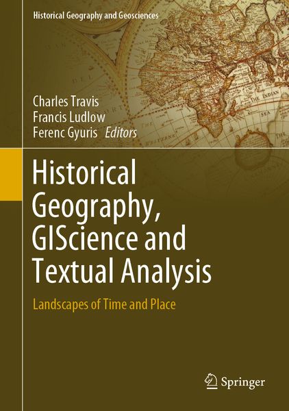
Historical Geography, GIScience and Textual Analysis Landscapes of Time and Place
Aus der Reihe
Historical Geography and Geosciences
-
- Hardcover ausgewählt
- Taschenbuch
- eBook
-
Sprache:Englisch
Fr. 209.00
inkl. gesetzl. MwSt.,
Beschreibung
Produktdetails
Einband
Gebundene Ausgabe
Erscheinungsdatum
01.03.2020
Herausgeber
Charles Travis + weitereVerlag
SpringerSeitenzahl
272
Maße (L/B/H)
26/18.3/2.1 cm
Gewicht
817 g
Auflage
1st ed. 2020
Sprache
Englisch
ISBN
978-3-030-37568-3
This book illustrates how literature, history and geographical analysis complement and enrich each other’s disciplinary endeavors. The Hun-Lenox Globe, constructed in 1510, contains the Latin phrase 'Hic sunt dracones' ('Here be dragons'), warning sailors of the dangers of drifting into uncharted waters. Nearly half a millennium earlier, the practice of ‘earth-writing’ (geographia) emerged from the cloisters of the great library of Alexandria, as a discipline blending the twin pursuits of Strabo’s poetic impression of places, and Herodotus’ chronicles of events and cultures. Eratosthenes, a librarian at Alexandria, and the mathematician Ptolemy employed geometry as another language with which to pursue ‘earth-writing’. From this ancient, East Mediterranean fount, the streams of literary perception, historical record and geographical analysis (phenomenological and Euclidean) found confluence. The aim of this collection is to recover such means and seek the fount of such rich waters, by exploring relations between historical geography, geographic information science (GIS) / geoscience, and textual analysis. The book discusses and illustrates current case studies, trends and discourses in European, American and Asian spheres, where historical geography is practiced in concert with human and physical applications of GIS (and the broader geosciences) and the analysis of text - broadly conceived as archival, literary, historical, cultural, climatic, scientific, digital, cinematic and media.
Time as a multi-scaled concept (again, broadly conceived) is the pivot around which the interdisciplinary contributions to this volume revolve. In The Landscape of Time (2002) the historian John Lewis Gaddis posits: “What if we were to think of history as a kind of mapping?” He links the ancient practice of mapmaking with the three-part conception of time (past, present, and future). Gaddis presents the practices of cartography and historical narrative as attempts to manage infinitely complex subjects by imposing abstract grids to frame the phenomena being examined— longitude and latitude to frame landscapes and, occidental and oriental temporal scales to frame timescapes. Gaddis contends that if the past is a landscape and history is the way we represent it, then it follows that pattern recognition constitutes a primary form of human perception, one that can be parsed empirically, statistically and phenomenologically. In turn, this volume reasons that literary, historical, cartographical, scientific, mathematical, and counterfactual narratives create their own spatio-temporal frames of reference. Confluences between the poetic and the positivistic; the empirical and the impressionistic; the epic and the episodic; and the chronologic and the chorologic, can be identified and studied by integrating practices in historical geography, GIScience / geoscience and textual analysis. As a result, new perceptions and insights, facilitating further avenues of scholarship into uncharted waters emerge. The various ways in which geographical, historical and textual perspectives are hermeneutically woven together in this volume illuminates the different methods with which to explore terrae incognitaes of knowledge beyond the shores of their own separate disciplinary islands.
Time as a multi-scaled concept (again, broadly conceived) is the pivot around which the interdisciplinary contributions to this volume revolve. In The Landscape of Time (2002) the historian John Lewis Gaddis posits: “What if we were to think of history as a kind of mapping?” He links the ancient practice of mapmaking with the three-part conception of time (past, present, and future). Gaddis presents the practices of cartography and historical narrative as attempts to manage infinitely complex subjects by imposing abstract grids to frame the phenomena being examined— longitude and latitude to frame landscapes and, occidental and oriental temporal scales to frame timescapes. Gaddis contends that if the past is a landscape and history is the way we represent it, then it follows that pattern recognition constitutes a primary form of human perception, one that can be parsed empirically, statistically and phenomenologically. In turn, this volume reasons that literary, historical, cartographical, scientific, mathematical, and counterfactual narratives create their own spatio-temporal frames of reference. Confluences between the poetic and the positivistic; the empirical and the impressionistic; the epic and the episodic; and the chronologic and the chorologic, can be identified and studied by integrating practices in historical geography, GIScience / geoscience and textual analysis. As a result, new perceptions and insights, facilitating further avenues of scholarship into uncharted waters emerge. The various ways in which geographical, historical and textual perspectives are hermeneutically woven together in this volume illuminates the different methods with which to explore terrae incognitaes of knowledge beyond the shores of their own separate disciplinary islands.
Noch keine Bewertungen vorhanden
Verfassen Sie die erste Bewertung zu diesem Artikel
Helfen Sie anderen Kundinnen und Kunden durch Ihre Meinung.