Remote Sensing of African Mountains Geospatial Tools Toward Sustainability
-
- Hardcover
- Taschenbuch ausgewählt
- eBook
-
Sprache:Englisch
Fr. 137.00
inkl. gesetzl. MwSt.,
Beschreibung
Produktdetails
Einband
Taschenbuch
Erscheinungsdatum
01.09.2023
Herausgeber
Samuel Adelabu + weitereVerlag
SpringerSeitenzahl
247
Maße (L/B/H)
23.5/15.5/1.5 cm
Gewicht
417 g
Auflage
1st ed. 2022
Sprache
Englisch
ISBN
978-3-031-04857-9
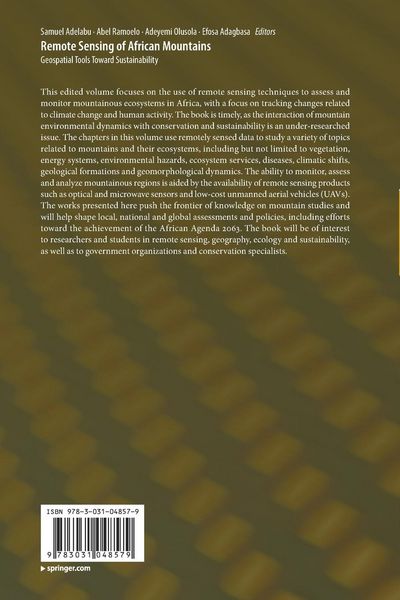
This edited volume focuses on the use of remote sensing techniques to assess and monitor mountainous ecosystems in Africa, with a focus on tracking changes related to climate change and human activity. The book is timely, as the interaction of mountain environmental dynamics with conservation and sustainability is an under-researched issue. The chapters in this volume use remotely sensed data to study a variety of topics related to mountains and their ecosystems, including but not limited to vegetation, energy systems, environmental hazards, ecosystem services, diseases, climatic shifts, geological formations and geomorphological dynamics. The ability to monitor, assess and analyze mountainous regions is aided by the availability of remote sensing products such as optical and microwave sensors and low-cost unmanned aerial vehicles (UAVs). The works presented here push the frontier of knowledge on mountain studies and will help shape local, national and global assessments and policies, including efforts toward the achievement of the African Agenda 2063. The book will be of interest to researchers and students in remote sensing, geography, ecology and sustainability, as well as to government organizations and conservation specialists.
Kundinnen und Kunden meinen
Verfassen Sie die erste Bewertung zu diesem Artikel
Helfen Sie anderen Kund*innen durch Ihre Meinung