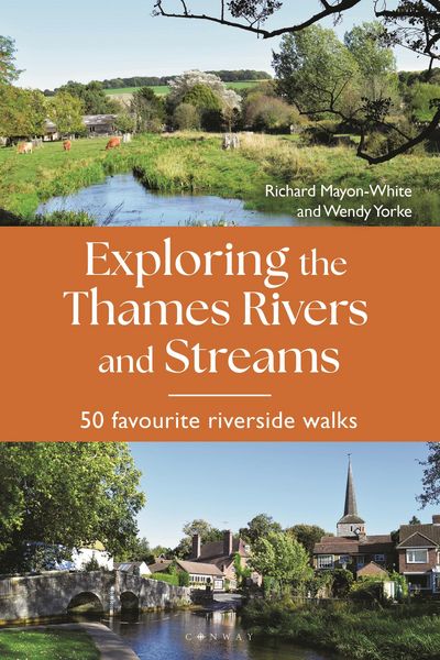
Produktbild: Exploring the Thames Rivers and Streams

Exploring the Thames Rivers and Streams 50 favourite riverside walks

Fr. 37.90

inkl. gesetzl. MwSt., Versandkostenfrei


Beschreibung

Produktdetails

Einband

Taschenbuch

Erscheinungsdatum

08.05.2025

Verlag

Bloomsbury Academic

Seitenzahl

304

Maße (L/B/H)

23/15.4/1.8 cm

Gewicht

680 g

Sprache

Englisch

ISBN

978-1-84486-671-7

Beschreibung

Produktdetails

Einband

Taschenbuch

Erscheinungsdatum

08.05.2025

Verlag

Bloomsbury Academic

Seitenzahl

304

Maße (L/B/H)

23/15.4/1.8 cm

Gewicht

680 g

Sprache

Englisch

ISBN

978-1-84486-671-7

Herstelleradresse

Libri GmbH
Europaallee 1
36244 Bad Hersfeld
DE

Email: gpsr@libri.de

Noch keine Bewertungen vorhanden

Verfassen Sie die erste Bewertung zu diesem Artikel

Helfen Sie anderen Kundinnen und Kunden durch Ihre Meinung.

Kundinnen und Kunden meinen

Bewertungen (0)

  • Produktbild: Exploring the Thames Rivers and Streams
  • Introduction

    Part 1: The rivers entering the Thames in Gloucestershire and Wiltshire

    Chapter 1: Swill Brook
    Walk 1: Lower Mill Farm and Swillbrook Nature Reserve; 4.5 miles (7km)

    Chapter 2: River Churn
    Walk 2: Around the Seven Springs; 5.8 miles (9km)
    Walk 3: Cirencester to Baunton; 5 miles (8km)

    Chapter 3: River Key (no favourite walk)

    Chapter 4: Ampney Brook
    Walk 4: Cricklade and Down Ampney; 5.5 miles (9km)

    Chapter 5: River Ray (Wiltshire)
    Walk 5: Shaw Forest to Purton Wood via Mouldon Park; 5 miles (8km)

    Chapter 6: River Cole
    Walk 6: Coate Water to Chisledon; 3 miles (4.8km)

    Chapter 7: River Coln
    Walk 7: Chetworth Roman Villa to Fossebridge; 6.5 miles (10km)
    Walk 8: Bibury to Coln St Alywns; 5 miles (4km)

    Chapter 8: River Leach
    Walk 9: Northleach to Hampnett and Upper End; 6.5 miles (10.5km)

    Part 2: The rivers entering the Thames in Oxfordshire

    Chapter 9: River Windrush
    Walk 10: Sherbourne to Windrush village; 5 miles (8km)
    Walk 11: Minster Lovell; 3.5 miles (5.6km)

    Chapter 10: River Evenlode
    Walk 12: Charlbury, Chilson and Pudlicote; 7 miles (11km)
    Walk 13: East End Roman Villa; 3.5 miles (6km)

    Chapter 11: River Cherwell
    Walk 14: Charwelton and Hellidon; 4 miles (6.4km)
    Walk 15: Kirtlington; 5 miles (8km)

    Chapter 12: River Ock
    Walk 16: Letcombe Brook; 5 miles (8km)

    Chapter 13: River Thame
    Walk 17: Dorchester to Long Wittenham; 8 miles (13km)

    Part 3: The rivers entering the Thames in Berkshire and Buckinghamshire

    Chapter 14: River Pang
    Walk 18: Stanford Dingle to Bradfield; 5 miles (8km)
    Walk 19: Pangbourne and Moor Copse; 4.5 miles (7km)

    Chapter 15: River Kennet
    Walk 20: Avebury to Silbury and East Kennet; 5 miles (8km)
    Walk 21: Speen to Donnington Castle and Bagnor: 5.3 miles (8.5km)
    Walk 22: Thatcham to the River Enborne and Greenham Common; 8 miles (13km)

    Chapter 16: River Loddon
    Walk 23: The Basing Trail at Basingstoke; 7 miles (10km)
    Walk 24: Dinton Pastures to Twyford and back; 7.7 miles (12km)
    Walk 25: North Warnborough to Greywell and Odiham Castle; 4 miles (6km)

    Chapter 17: River Wye
    Walk 26: West Wycombe; 3 miles (5km)

    Part 4: The rivers entering the Thames in Surrey

    Chapter 18: River Colne
    Walk 27: Rickmansworth to Black Jack's lock, near Mount Pleasant; 6 miles (9km)
    Walk 28: St Albans to Childwickbury and Redbournbury; 7.5 miles (12km)
    Walk 29: Chess Valley at Chenies; 6.8 miles (10km)

    Chapter 19: River Bourne
    Walk 30: Chertsey Meads to Weybridge; 5 miles (8km)

    Chapter 20: River Wye
    Walk 31: Tilford to Frensham Little Pond and Pierrepoint Farm; 5.5 miles (9km)
    Walk 32: Camelsdale to Black Down; 6 miles (10km)
    Walk 33: Godalming to Guildford; 5 miles (8km)

    Chapter 21: Mole
    Walk 34: Brockham Village Circular Walk; 5 miles (8km)
    Walk 35: Dorking to Leatherhead, via Box Hill and the Mole Gap Trail; 7 miles (12km)
    Walk 36: Cobham Circular Walk; 4 miles (6.5km)

    Part 5: The rivers entering the Thames in West London

    Chapter 22: River Hogsmill
    Walk 37: Riverside Walk from Ewell (source) to the Thames; 8 miles (12.8km)

    Chapter 23: River Crane
    Walk 38: Crane Park and Kneller Gardens; 5 miles (8km)

    Chapter 24: River Brent
    Walk 39: Horsenden Hill to Brent River Park; 8.3 miles (13km)

    Chapter 25: Beverley Brook
    Walk 40: Richmond Park to Putney and back to Wimbledon, using a bus from Putney to Wimbledon; 9.2 miles (15km)

    Chapter 26: River Wandle
    Walk 41: Waddon Ponds to Morden Hall; 6.5 miles (10.4km)

    Part 6: The rivers that meet the Thames in and near East London

    Chapter 27: River Ravensbourne
    Walk 42: Keston Common; 3 miles (5km)

    Chapter 28: River Lea
    Walk 43: Hertford to Rye House; 7 miles (12km)
    Walk 44: Cheshunt, Fishers Green and Waltham Abbey; 5 miles (8km)
    Walk 45: Walthamstow Marshes to Hackney Marsh; 6 miles (10km)

    Chapter 29: River Roding
    Walk 46: Loughton; 4 miles (6.4km)

    Chapter 30: River Rom and Beam
    Walk 47: Dagenham; 5 miles (8km)

    Chapter 31: River Ingrebourne
    Walk 48: Hornchurch Country Park; 6 miles (9.6km)

    Chapter 32: River Darent
    Walk 49: Otford to Shoreham and Eynsford (return by train); 5.5 miles (8.8km)

    Chapter 33: The Mardyke
    Walk 50: Davy Down and North Shifford; 3.5 miles (5.6km)