Produktbild: Himalayan Flood Hazards
Vorbesteller Neu

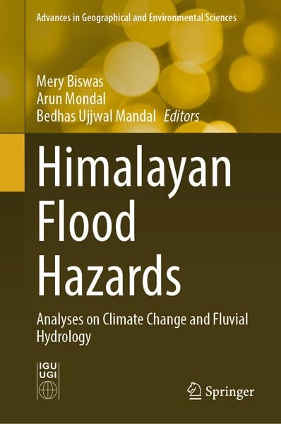
Himalayan Flood Hazards Analyses on Climate Change and Fluvial Hydrology

Fr. 181.00

inkl. gesetzl. MwSt., Versandkostenfrei


Beschreibung

Produktdetails

Einband

Gebundene Ausgabe

Erscheinungsdatum

10.07.2026

Abbildungen

VI, 150 illus., 141 illus. in color., farbige Illustrationen, schwarz-weiss Illustrationen

Herausgeber

Mery Biswas + weitere

Verlag

Springer Singapore

Seitenzahl

295

Maße (L/B)

23.5/15.5 cm

Sprache

Englisch

ISBN

978-981-9207-01-5

Beschreibung

Portrait

Dr. Mery Biswas: Dr. Biswas is an Associate Professor in the Department of Geography at Presidency University, Kolkata. She completed her Ph.D. under Prof. S. C. Mukhopadhyay at the University of Calcutta in 2009, focusing on landforms and land use, with special emphasis on fluvial aggradation–degradation processes and landform deformation. Her research spans multiple approaches to morphotectonics and fluvial geomorphology (including field-based methods, instrumental survey techniques, analytical models, and micro-landform analysis) as well as contemporary landscape hazards. She investigates diverse morphological regimes, landscape change, and hydro-sediment interactions from the Himalayan foothills to higher altitudes, examining riverscape dynamics and hazard perspectives across different terrain settings. Her ongoing research focuses on applied tectonics and fluvial landscape studies, sediment ecology, and emerging geo-hazard patterns and environmental issues in Himalayan terrain. As Principal Investigator, she successfully completed a DST-SERB project (2021–2024), resulting in three international journal articles and one book. In 2025, she was awarded an ICSSR project as a Co-Investigator. She has published extensively on flood hazards and recurrent geohazards driven by autogenic and allogenic factors. Her expertise includes riverscape dynamics, hazard response, tectonic interactions, and compound-hazard assessment, with a particular interest in links between riverscapes and infrastructure, riverine water–sediment health, and adjacent landscape suitability.


Dr. Arun Mondal: Dr. Mondal is an accomplished academic and researcher in Geography, specializing in hydrology, climate change, and remote sensing. He is currently an Assistant Professor in the Department of Geography at the University of Allahabad (a Central University), Prayagraj, India, where he has been engaged in teaching, research, and academic mentoring since 2023. He earned his B.Sc. and first M.Sc. degrees in Geography from the University of Calcutta, Kolkata, India, and his second M.Sc. in Geo-information Science and Earth Observation (a joint programme) from the University of Twente, the Netherlands, and the Indian Institute of Remote Sensing, Dehradun, India. He received his Ph.D. in Water Resources Development and Management from the Indian Institute of Technology (IIT) Roorkee, India. He also completed postdoctoral research at the University of South Carolina, USA, supported by the SERB Indo–US Postdoctoral Fellowship and the World Bank. His research interests include the impacts of climate and land-use change; flood and drought analysis; hydrological and hydrodynamic modelling; soil erosion; evapotranspiration; and satellite-based precipitation analysis. Dr. Mondal has published more than 60 research articles in reputed international journals, as well as book chapters. He also serves as a guest editor and reviewer for several high-impact journals.


Dr. Bedhas Ujjwal Mandal: Dr. Mandal was awarded the Ph.D. degree in Geography from the University of Calcutta in 2013. His doctoral research focused on fluvial landforms and potential land issues in micro-level, higher Himalayan watersheds. He currently works in physical geography, with a focus on environmental hazards. In particular, his research examines how endogenetic and exogenetic processes affect the diverse Himalayan terrain and the surrounding tectonically sensitive zones, and how these processes influence a range of natural and quasi-natural hazards, using remote sensing and GIS alongside field investigation and validation. His current work concentrates on hazards in the Eastern Himalaya, with special emphasis on glacial lake outburst floods (GLOFs) and flash-flood-related hazards.

Produktdetails

Einband

Gebundene Ausgabe

Erscheinungsdatum

10.07.2026

Abbildungen

VI, 150 illus., 141 illus. in color., farbige Illustrationen, schwarz-weiss Illustrationen

Herausgeber

Verlag

Springer Singapore

Seitenzahl

295

Maße (L/B)

23.5/15.5 cm

Sprache

Englisch

ISBN

978-981-9207-01-5

Herstelleradresse

Libri GmbH
Europaallee 1
36244 Bad Hersfeld
DE

Email: GPSR Kontakt

Noch keine Bewertungen vorhanden

Verfassen Sie die erste Bewertung zu diesem Artikel

Helfen Sie anderen Kundinnen und Kunden durch Ihre Meinung.

Kundinnen und Kunden meinen

Bewertungen (0)

  • Produktbild: Himalayan Flood Hazards
  • 1. Flood Inundation mapping in Ramganga river basin using Synthetic Aperture Radar (SAR) based Sentinel-1 data in 2018.- 2. Trend of Glacial Lake Outburst Floods (GLOFs) in the Central Himalayan region over last 25 years: A Review Based Approach.- 3. An overview of the hydrological responses of the Northern Himalayan basin under the climate variability.- 4. Assessment of heavy precipitation-induced flood studies on the Western Himalayas from 2002 to 2024: A review.- 5. At-Site Flood QuantileEstimation Using Multiparameter Distributions in the Gandak River, Himalayas.