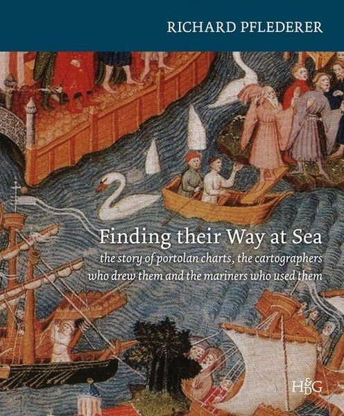
Finding Their Way at Sea The Story of the Portolan Charts, the Cartographers Who Drew Them and the Mariners Who Sailed by Them
-
- Englisch ausgewählt
Fr. 94.90
inkl. gesetzl. MwSt.,
Beschreibung
Produktdetails
Einband
Gebundene Ausgabe
Erscheinungsdatum
01.01.2012
Verlag
BrillSeitenzahl
168
Maße (L/B/H)
29.7/25.3/1.7 cm
Gewicht
1050 g
Sprache
Englisch
ISBN
978-90-6194-490-4
The story of sea charts, of manuscript portolan charts in particular, is a story intimately intertwined with the history of the western world during some of the most significant and eventful periods of recorded history. Through these astonishingly beautiful and functional charts, we can trace developments in trade and warfare, exploration and colonial domination from the late medieval period through the Renaissance and into the Age of European Enlightenment.
Beginning with their introduction in the late thirteenth century, these sometimes quaintly fanciful portolan charts enjoyed an important place in the navigator's sea chest until they were finally superceded in the eighteenth century by their cheaper but far less charming printed cousins. In the mid-fifteenth century when the Europeans first ventured beyond their home waters and into the open oceans, their successes and their sometimes-heroic failures were documented on charts of the newly discovered oceans and coasts. These new charts, although depicting faraway coasts and employing the latest navigational techniques, were drawn on vellum in the same style as Mediterranean Sea charts. They served the dual purposes of recording information gleaned from previous voyages and guiding the mariners of subsequent voyages.
Beginning with their introduction in the late thirteenth century, these sometimes quaintly fanciful portolan charts enjoyed an important place in the navigator's sea chest until they were finally superceded in the eighteenth century by their cheaper but far less charming printed cousins. In the mid-fifteenth century when the Europeans first ventured beyond their home waters and into the open oceans, their successes and their sometimes-heroic failures were documented on charts of the newly discovered oceans and coasts. These new charts, although depicting faraway coasts and employing the latest navigational techniques, were drawn on vellum in the same style as Mediterranean Sea charts. They served the dual purposes of recording information gleaned from previous voyages and guiding the mariners of subsequent voyages.
Noch keine Bewertungen vorhanden
Verfassen Sie die erste Bewertung zu diesem Artikel
Helfen Sie anderen Kundinnen und Kunden durch Ihre Meinung.