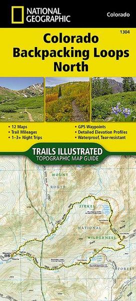
Colorado Backpack Loops North Map
-
- Englisch ausgewählt
Fr. 22.90
inkl. gesetzl. MwSt.,
-
Kostenlose Lieferung ab Fr. 30 Einkaufswert
Schweiz & Liechtenstein:
Versandkostenfrei ab Fr. 30.00
Versandkosten bis Fr. 30.00: Fr. 3.50Andere Lieferländer
Fr. 18.00 unabhängig vom Warenwert
Beschreibung
Produktdetails
Einband
Karte
Erscheinungsdatum
01.01.2024
Verlag
National geographicSeitenzahl
36
Maße (L/B/H)
15.5/10.6/0.6 cm
Gewicht
67 g
Auflage
2024th edition
Sprache
Englisch
ISBN
978-1-56695-755-7
- Waterproof - Tear-Resistant - Topographic Map
Colorado is renowned for its outdoor recreational opportunities. One of these pastimes is, of course, backcountry hiking.
- The Colorado Backpack Loops North Topographic Map Guide covers a dozen backpack loops selected by National Geographic staff for their diversity, remoteness, and inspiring vistas.
- Each page of the Topographic Map Guide includes a detailed map of the trail with directions to the trailhead from the nearest major town as well as a trail profile with mileages to foreshadow the elevation changes that will be met along the way.
- GPS coordinates are also provided for strategic points along the trail to help with navigation.
- The trails are organized by the number of nights backpackers can expect to be in the backcountry, from one to more than three.
- They range from 8 to 25 miles long with elevation gains from 2,000 to over 7,000 feet.
Written descriptions of each trail give an overview of the natural features that will be encountered along the way as well as the length, total elevation gain, and nearest town to each trailhead. This Topographic Map Guide will get you into the wild lands of northern Colorado that most hikers in the country can only dream about.
More convenient and easier to use than folded maps, but just as compact and lightweight, National Geographic's Topographic Map Guide booklets are printed on "Backcountry Tough" waterproof, tear-resistant paper with stainless steel staples. A full UTM grid is printed on the map to aid with GPS navigation.
Other features found on this map include: Mount Zirkel, Pike National Forest.
- Map Scale = 1:40,680 & 1:63,360
- Folded Size = 4.25" x 9.38"
Noch keine Bewertungen vorhanden
Verfassen Sie die erste Bewertung zu diesem Artikel
Helfen Sie anderen Kundinnen und Kunden durch Ihre Meinung.