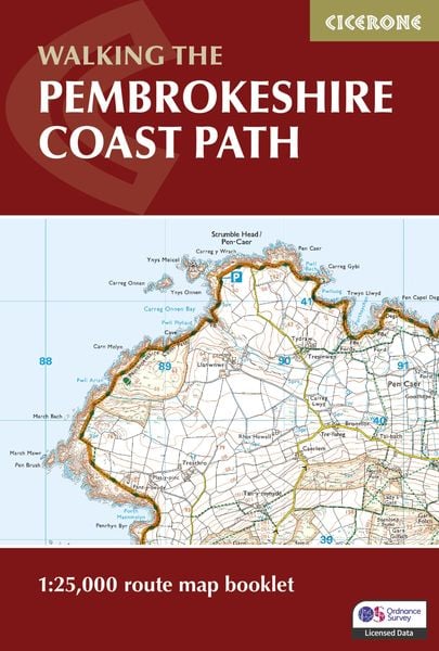
Pembrokeshire Coast Path Map Booklet 1:25,000 OS Route Mapping
-
- Englisch ausgewählt
Fr. 25.90
inkl. gesetzl. MwSt.,
-
Kostenlose Lieferung ab Fr. 30 Einkaufswert
Schweiz & Liechtenstein:
Versandkostenfrei ab Fr. 30.00
Versandkosten bis Fr. 30.00: Fr. 3.50Andere Lieferländer
Fr. 18.00 unabhängig vom Warenwert
Beschreibung
Produktdetails
Einband
Taschenbuch
Erscheinungsdatum
15.02.2024
Verlag
Cicerone Press LimitedSeitenzahl
80
Maße (L/B/H)
16.7/11.2/0.7 cm
Gewicht
94 g
Farbe
Weiß / Weinrot
Auflage
2 Revised edition
Sprache
Englisch
ISBN
978-1-78631-209-9
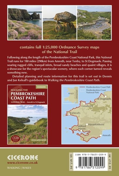
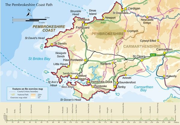
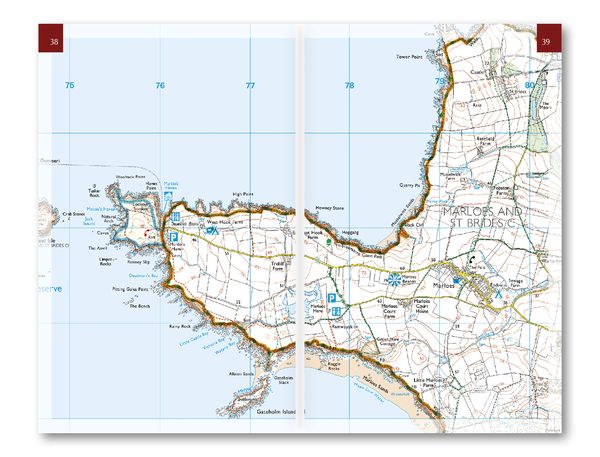
A booklet of all the mapping needed to walk the Pembrokeshire Coast Path National Trail between Amroth near Tenby and St Dogmaels by Cardigan. Covering 290km (180 miles) and over 10,500m of ascent, this trail takes around 2 weeks to complete.
- The full route is shown on 1:25,000 OS maps
- The map booklet can be used to walk the trail in either direction
- Sized to easily fit in a jacket pocket or rucksack
- The relevant extract from the OS Explorer map legend is included
- High tide and military range closure alternate routes are provided
- An accompanying Cicerone guidebook – Walking the Pembrokeshire Coast Path is also available, which includes a copy of this map booklet
Kundinnen und Kunden meinen
Verfassen Sie die erste Bewertung zu diesem Artikel
Helfen Sie anderen Kund*innen durch Ihre Meinung