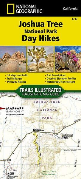
Joshua Tree National Park Day Hikes Map
-
- Englisch ausgewählt
Fr. 27.90
inkl. gesetzl. MwSt.,
-
Kostenlose Lieferung ab Fr. 30 Einkaufswert
Schweiz & Liechtenstein:
Versandkostenfrei ab Fr. 30.00
Versandkosten bis Fr. 30.00: Fr. 3.50Andere Lieferländer
Fr. 18.00 unabhängig vom Warenwert
Beschreibung
Produktdetails
Einband
Karte
Erscheinungsdatum
20.06.2024
Verlag
National geographicSeitenzahl
48
Maße (L/B/H)
23.8/10.9/0.5 cm
Gewicht
83 g
Farbe
Lichtgrau / Anthrazit
Auflage
2024th edition
Sprache
Englisch
ISBN
978-1-56695-948-3
- Waterproof - Tear-Resistant - Topographic Map
Two deserts, two large ecosystems primarily determined by elevation, come together at Joshua Tree National Park. Few areas more vividly illustrate the contrast between high and low desert.
- Below 3,000 feet, the Colorado Desert, occupying the eastern half of the park, is dominated by the abundant creosote bush.
- Adding interest to this arid land are small stands of spidery ocotillo and jumping cholla cactus.
- The higher, slightly cooler and wetter, Mojave Desert is the special habitat of the undisciplined Joshua tree, extensive stands of which occur throughout the western half of the park.
- A rich cultural history and surreal geologic features offer additional opportunities for exploration.
- The Joshua Tree National Parks Day Hikes Topographic Map Guide contains detailed maps for 16 of Joshua Tree's finest day hikes.
- It includes well-known hikes and some off-the-beaten-path trails.
- They range from easy strolls to strenuous climbs, selected to give you a sampling of all the park has to offer.
- Together, they cover over 60 miles of adventures.
- One-third of the selected hikes are less than 3 miles long, two-thirds are less than 6 miles, and two hike are longer than 7 miles long.
- Each of the 16 maps include directions to the trailhead, the total distance to complete the hike, and an estimate of the degree of difficulty.
Also provided are elevations of key points on the trail, an elevation profile for the hike, and a calculation of the hike's total elevation gain. Concise trail descriptions will help you find the hikes that best suit your interests, conditioning, and available time.
Every Trails Illustrated map is printed on "Backcountry Tough" waterproof, tear-resistant paper. A full UTM grid is printed on the map to aid with GPS navigation. Every map purchase helps support the National Geographic Society, an impact driven, nonprofit organization with global reach that uses the power of science, exploration, education, and storytelling to illuminate and protect the wonder of our world.
- Map Scale = 1:40,000 & 1:20,000
- Folded Size = 4.25" x 9.38"
Noch keine Bewertungen vorhanden
Verfassen Sie die erste Bewertung zu diesem Artikel
Helfen Sie anderen Kundinnen und Kunden durch Ihre Meinung.