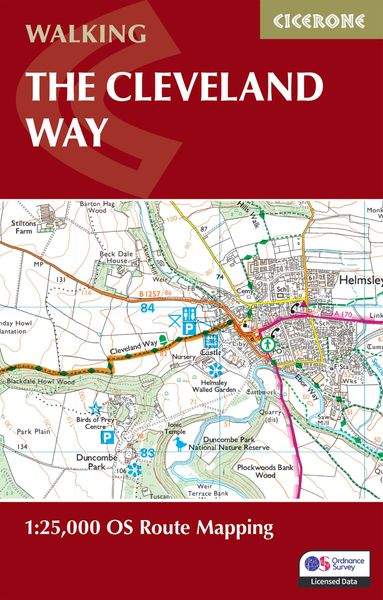
The Cleveland Way Map Booklet 1:25,000 OS Route Mapping
-
- Taschenbuch ausgewählt
- eBook
-
Sprache:Englisch
-
Auflage:2 Revised edition
Fr. 19.90
inkl. gesetzl. MwSt.,
-
Kostenlose Lieferung ab Fr. 30 Einkaufswert
Schweiz & Liechtenstein:
Versandkostenfrei ab Fr. 30.00
Versandkosten bis Fr. 30.00: Fr. 3.50Andere Lieferländer
Fr. 18.00 unabhängig vom Warenwert
Beschreibung
Produktdetails
Einband
Taschenbuch
Erscheinungsdatum
14.06.2024
Verlag
Cicerone Press LimitedSeitenzahl
64
Maße (L/B/H)
16.4/10.3/0.5 cm
Gewicht
70 g
Auflage
2 Revised edition
Sprache
Englisch
ISBN
978-1-78631-222-8
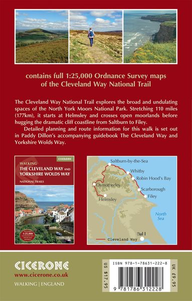
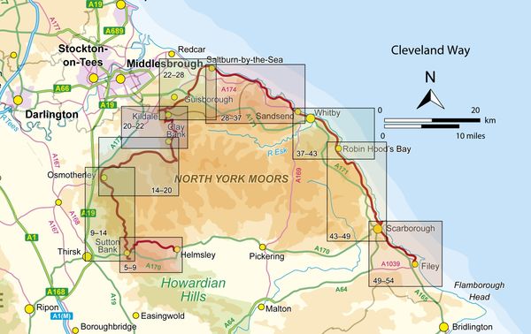
A booklet of all the mapping needed to complete the Cleveland Way National Trail between Helmsley and Filey. Covering 117km (110 miles) around the North York Moors National Park this straightforward hike takes around 1 week to walk.
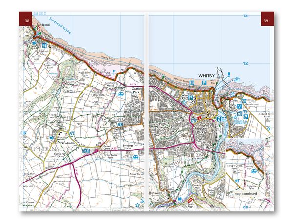
- The full route line is shown on 1:25K OS maps
- The map booklet can be used to walk the trail in either direction
- Sized to easily fit in a jacket pocket
- The relevant extract from the OS Explorer map legend is included
- An accompanying Cicerone guidebook – Walking the Cleveland Way and Yorkshire Wolds Way is also available, which includes a copy of this map booklet
Kundinnen und Kunden meinen
Verfassen Sie die erste Bewertung zu diesem Artikel
Helfen Sie anderen Kund*innen durch Ihre Meinung